Integrating participatory planning in the design of Belize’s marine replenishment zones
 Image credit: Seleni Cruz
Abstract
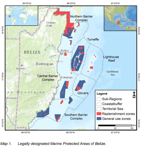
The Belize Fisheries Department in collaboration with national and international conservation organizations has recognized the need for an expanded network of marine replenishment zones (RZs) as a critical component in a framework for sustainable management of fisheries, biodiversity and adaptability to climate change. Currently, only 2.6% of Belize’s territorial waters are managed as RZs where no extractive activities are allowed. The effectiveness of these zones in replenishing fish stocks and enabling the recovery of damaged or degraded ecosystems is limited in part by the zones’ small sizes and fragmented nature. The Nature Conservancy has led the effort of planning and conducting geospatial analysis for the expansion of the network of RZs to including at least ten percent of all major marine-habitat types within Belize’s territorial waters. A design criterion was developed to guide the spatial analysis and Marxan was used to identify priority areas for expansion through a systematic spatial assessment of the conservation values and socioeconomic uses. Simultaneously, a customized ArcGIS-interface decision-support tool (DST) was developed that exposes the conservation values found in any given area and allows planners and stakeholders to interactively and quantitatively compare alternative RZ scenarios. The DST facilitates a participatory process among stakeholders, which enables planning teams to make informed decisions regarding the refinement and final selection of a single, preferred, RZ design. A draft design for the RZ network has been completed and will be used in conjunction with the DST during wider stakeholder consultations.
Type
Publication
GIS/Spatial Analyses in Fishery and Aquatic Sciences